3 Nights in the Desert
In 2017 I have decided that I am going to focus on just a couple of big events and probably pepper in a few others for fun. The first big thing for this year is the Arizona Trail Race. For those that have never heard of it, there are two versions. One is around 300 miles and runs from just north of the Mexico border and ends east of Phoenix. The other is somewhere between 750 and 800 miles starting right on the Mexico border and ending at the Utah border. I am doing the latter.

Final route up the AZT
Having no more experience with desert riding that what I was exposed to at Stagecoach last year, Lynda and I thought it would be a good idea to get an easy recon ride in before we started buckling down into training mode. She recommended riding from Oracle to Picketpost which would amount to about 100 miles of trail. For a few months, I wrestled with different options to make logistics as simple as possible. First I thought I would ride a loop starting from Phoenix taking highways down to Oracle then head back on on the AZT racking. Then I thought I would go big flying into Tucson and riding to Phoenix. Both of these options were 200+ miles and would take way more time than I had available for a scouting trip. I finally decided to just fly into Phoenix, shuttle to Oracle and ride back up on the trail racking up around 140 miles total.
Preparation
From the reading I have done I found that most folks are riding full suspension bikes on the big route. I have never owned a FS bike but had been doing a good bit of research and test riding over the past couple of years. Back in November I picked up a Santa Cruz Tallboy after demoing it at the factory in California and only had the chance to get a few local rides on it before throwing it in a box and shipping it to Jones Two Wheel in Gilbert, AZ. My goal with this 100 mile stretch was to break it up into about three days at a super mellow pace taking all the food I would need to get by without going off route. I have backpacked with a stove and real food before but have never taken these luxuries on a bikepacking trip. Calculating calorie requirements is something I have gotten somewhat proficient with over the past few of years of multiday trips and actually really enjoy nerding out on. For this trip I put a lot of focus on eating real food and minimizing robot food.

Number games
The only other missing link in planning this trip was getting from the hotel in Gilbert down to Oracle. Worst case I had planned on summoning an unsuspecting Uber driver to haul me and my bike 100 miles southeast. As fate would have it, a local friend of mine named Robert Lee was actually wrapping up a visit with family in the Phoenix area as I was arriving in town. He graciously offered to dump me at a gas station in Oracle on his way to Tucson. This was such a huge stress relief. Now all I had to do was ride and eat. A week out from my departure and my bike was en route, bags packed, ready to roll.
Day -1
Early AM flight out of Jackson to Phoenix on Thursday, December 15th. I was super relieved to see that my bike had made it to the shop and gave them a call to confirm on my layover in Atlanta. Getting into Phoenix I took an Uber to the hotel in Gilbert, grabbed a bite to eat and walked down to the bike shop to get things put together. Ray and the guys at Jones Two Wheel were super awesome. They gave me a little corner to put things together and we swapped some stories. Robert met me there and we piled my bike into the back of his truck to get back to the hotel. Eat, sleep, wake-up.
Day 1
Great night sleep. Ate, put on the clothes I'd be wearing for a few days then loaded back into the truck. Driving down to Oracle I was super relaxed and enjoyed easy conversation with Robert. About halfway there I realized I had forgotten my cheese in the hotel fridge. I had daydreamed about lunching on crackers, cheese and sausage. Totally shattered.
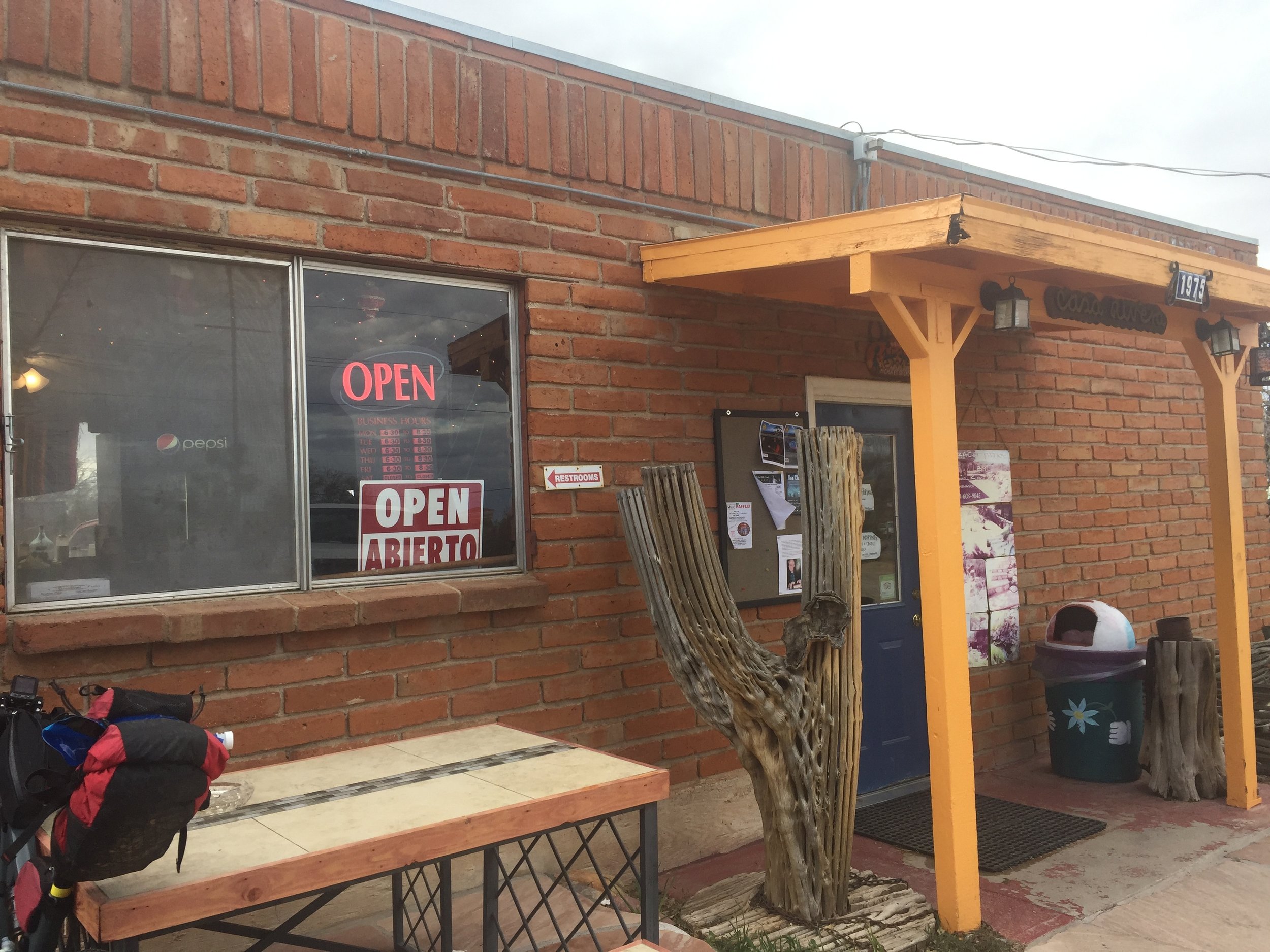
We cruised through the tiny town of Oracle which rested in the shadows of Mt Lemmon looking for a good place to dump me. I was interested looking for replacement cheese and maybe eating a second breakfast before heading out. Circle K right across from a tiny Mexican restaurant open for breakfast. Perfect. Cheese was secured and all was right in the world. Robert and I said our goodbyes then I headed across the street to eat the best chorizo breakfast burrito EVAR. So good. Hopefully the grease bomb wouldn't explode a few miles into trail. I waited until Wendi landed in NYC on a business trip so I could talk to her before heading out for a few days of possibly no cell coverage.
This isn't how you do it
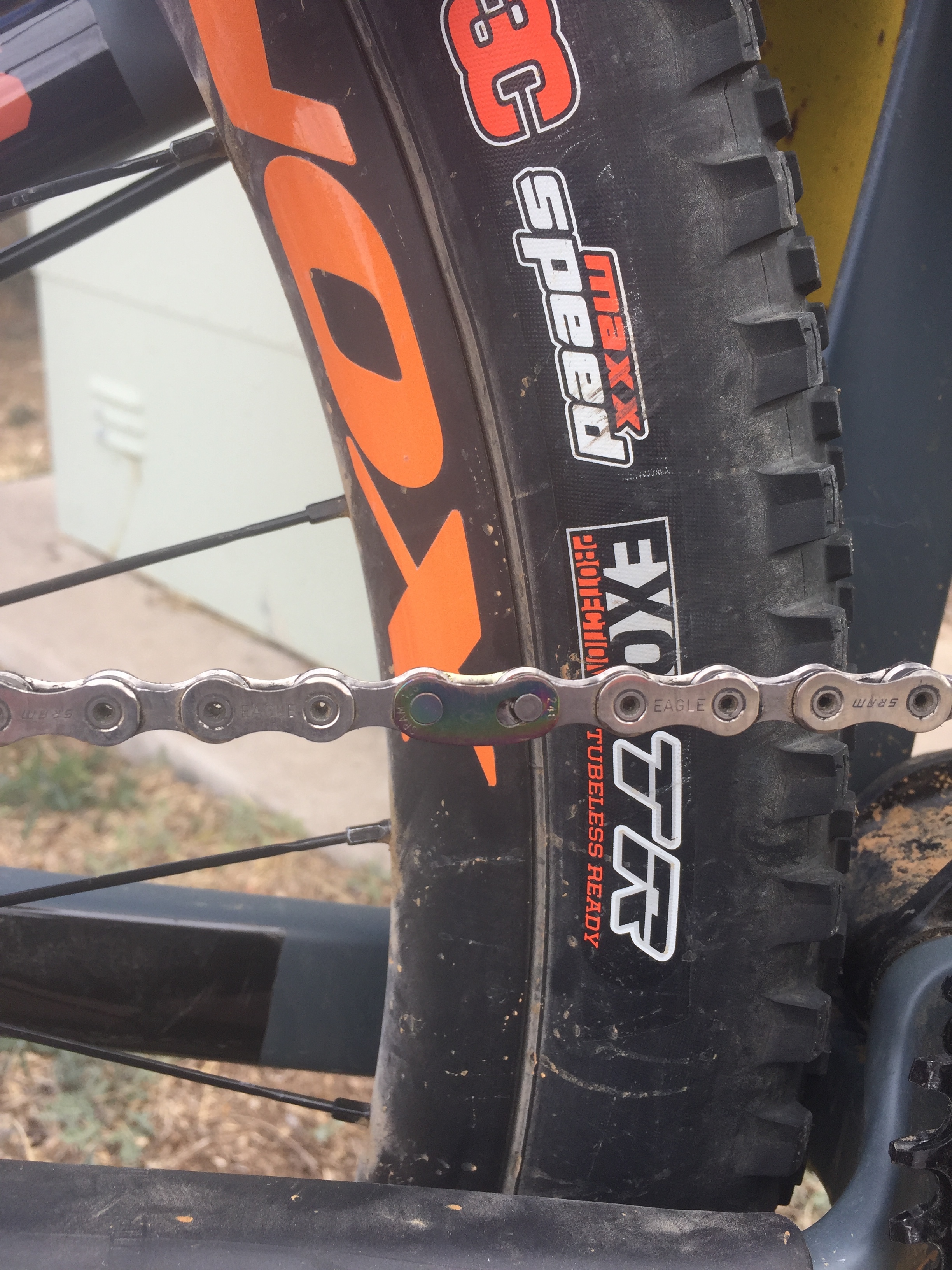
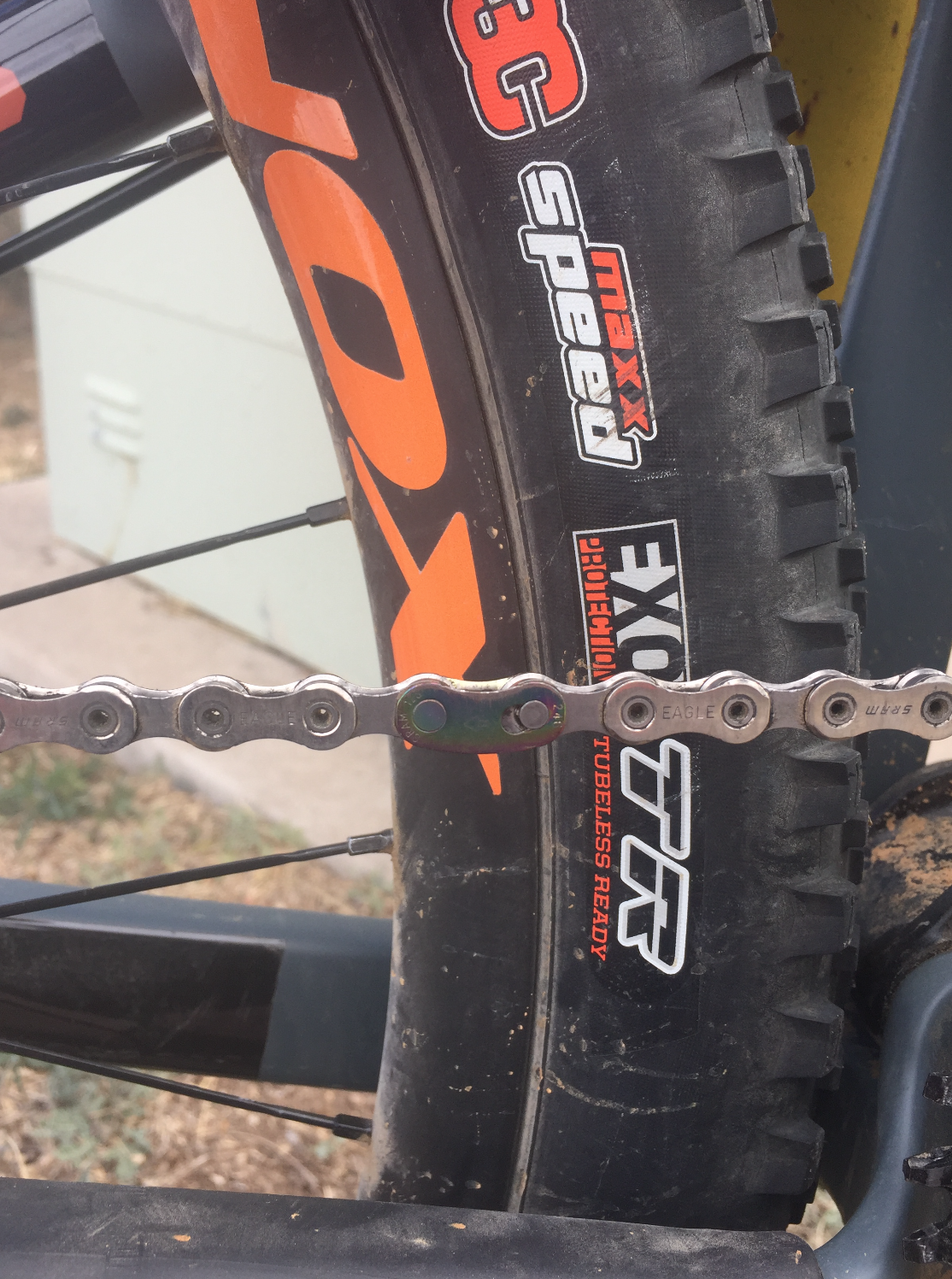
I pedaled out of town towards the Tiger Mine trailhead which was the southern terminus of the Black Hills Passage. Drive train was acting super clunky doing a weird ghost shift every couple of pedal rotations. I thought maybe it just needed a little adjustment so I turned the barrel to the extent both ways with no improvement. I pulled off the side of the road to try to diagnose. The group I had picked out for this bike was SRAMs new 12 speed Eagle setup which I had really liked on the few rides I had gotten in before this trip. Totally frustrated not being able to figure out the problem I finally noticed something as I was running my hand across the chain. The new 12 speed quicklink which holds the two ends of the chain together has an arc in it presumably to give it a better ride over the tiny 10 tooth small cog on the cassette. Given its shape, you can only properly install it in one direction. I didn't do that. I tried separating the link with a pair of leatherman pliers but ended up having to push the pin out and replacing with a new quicklink in the correct orientation. Back on the road, no more clunking.
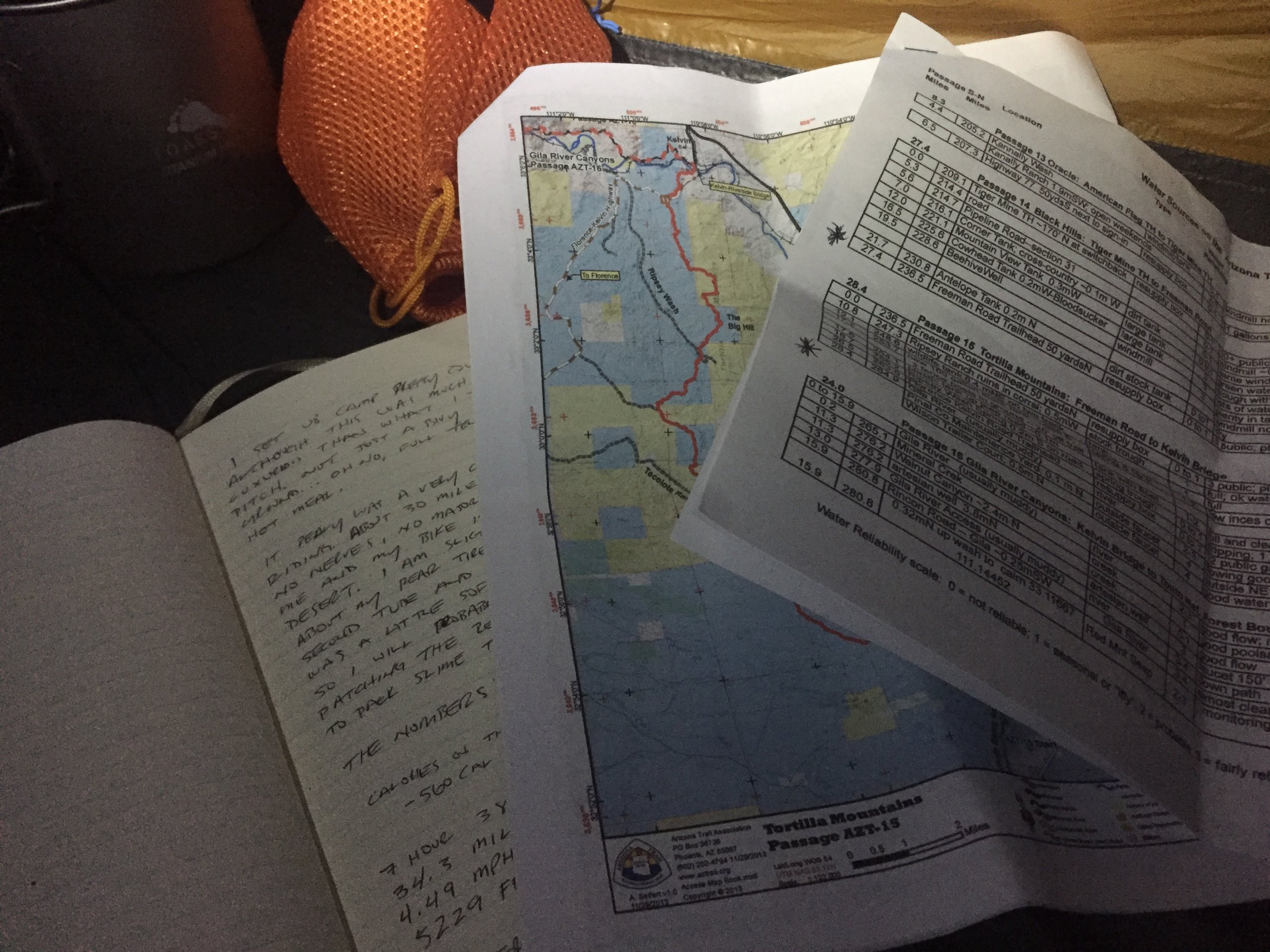
In just a few miles I arrived at the Tiger Mine trailhead. It was a large parking lot and there was no mistaking where the trail began. Super excited and a little nervous, I pushed my bike over the rail and pedaled into the unknown. This afternoon I was sort of treating like a bonus day. I had given myself all day to get here in case there were some delays or unexpected setbacks so I was really stoked to be on the trail. The goal today was to make it to the Freeman Road trailhead which was about 27 miles to the north. Desert trail was so much different than what I was accustom to in the southeast. No dirt, just rocks. Big rocks, little rocks and pumice sand in the washes. Following trail was pretty easy as it was well worn and very well marked with both standard brown carsonite signs as well as man-made cairns which sometimes were stacked every couple hundred feet. The Arizona trail has 43 passages in total each ranging from 10 to 36 miles. Black Hills was passage #14 and I had planned on riding through passage #17. Each section sort of has its own personality.

Getting better at this than I care to admit
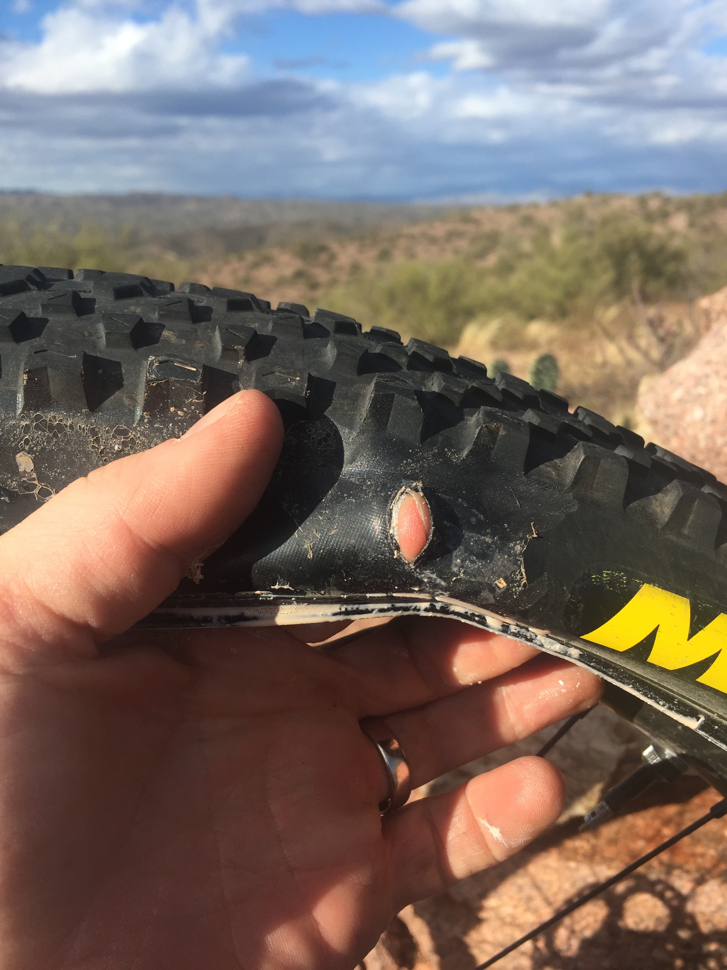
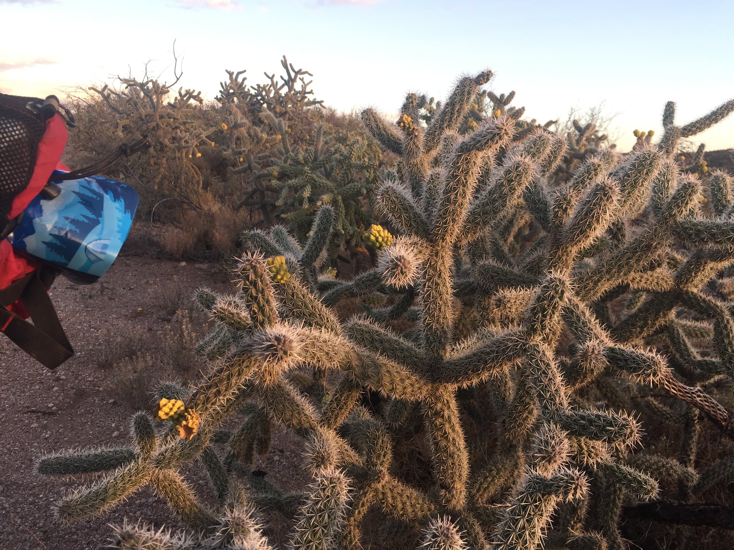
The Black Hills sort of gently went up and down giving a good intro to riding desert rock. Around mile 16 the trail dropped into a big wash that was pretty easy to find your through following the tire tracks of others. For those not familiar with the term "wash", it essentially a dry creek bed typically filled with pumice sand. Although they are normally dry, this is where all of the runoff from rain typically flows and you can see old striations through the wash where water has once run. Climbing out of the wash I made my way up another set of hills and then down a few steep drops with sharp rocks. On this descent I heard that sound of air escaping a tire.....a sound you really never want to hear. I stopped and checked it out. Big cut in the sidewall of my rear tire. Luckily I have been here before and knew how to handle it. I found a shady spot and proceeded to put a few stitches into a nice half inch cut. Threw a tube in it and was on my way. It was a very windy afternoon which had throw bits of cholla cactus all over the trail. This made me a little nervous given the freshly tubed rear tire lacking any sort of sealant to protect these little punctures.

Sun setting over the desert hills
The sun was starting to set but I knew I had to be getting close to the Freeman Road trailhead. Just as I turned my lights on I had come to a road that was marked with the same name as the trailhead displayed on my Garmin. Crossing the road and continuing on trail for another half mile I ran right into the well signed outpost. Tons of bottled water sitting on a resupply box was a mental boost and I made quick work of setting up camp as the wind was picking up. The forecast for the weekend had changed a few times over the past couple of days so I didn't really know what to expect. As opposed to a lightweight race mode sleep kit, I decided to bring a full tent with me on this trip. I knew it was going to be a little chilly and I also wanted to embrace the pleasure cruise mode of this trip. I changed into camp clothes and started cooking up a hot meal. After eating I review the maps for tomorrow and tucked in pretty early trying to ignore the howling wind outside the tent. Around 11pm I heard the drip drop of rain and the wind was really starting to pick up. Waves of 40+ mph gusts would momentarily collapse the sidewall of my tent. The rain picked up into a downpour. I knew that I was at fairly high ground and didn't need to worry about being in danger of a flash flood. All night it went like this.....waves of storms rolling through. Tent stakes evidently do not hold into wet sand very well and I had to get out a few times and resecure them but I was super happy to be bone dry inside of my Nemo Blaze tent. I would nod off a here and there but didn't get a great night sleep. Sometime in the wee hours the rain stopped and I feel asleep not waking till the sun peeked through nylon folds.
The numbers:
- Only around 850 calories on the bike. Chalking this up to that huge second breakfast and a mellow pace.
- 1K calories at dinner
- 7 hours & 38 minutes of riding (5hr 28m moving time)
- 34.3 miles - 4.49 mph average (6.3mph moving)
- 5229' vertical gain (didn't feel like that much)
- Strava activity here: https://www.strava.com/activities/806546985
Day 2
Eating a hot breakfast of oatmeal and coffee I started packing up and noticed a van in the trailhead parking lot. I went out to check it out and met a really nice local named Ira whom I convinced to sell me a spare tube. I had a second on me but felt much better picking up a third given the cut tire and the flat rear tire I had woken up to. The cholla had presumably poked some holes in it causing a slow leak. Ira gave me some pointers on the section of trail I would be riding today and I headed into passage 15 which is named the Tortilla Mountains. It was a chilly morning so I kept my rain pants and down jacket on as I set out on the flowy trail. One thing I immediately noticed was that the rain did a great job of washing the cholla grenades clear of the trail. Much less dodging and swerving to avoid them today. My rear tire was most definitely getting a little soft and I had to stop and put air in it every couple of hours. This passage was mostly downward trending for the first 18 miles on nice flowing single and double track. Looking at maps I knew that there was a feature called the "Big Hill" which looked more like a mountain in the distance. This was the first big feature I faced and the lack of vegetation made it very easy to see where the trail was etched into the mountain side. There were times where it disappeared behind a rise or a relief but typically came right back into view.
Great vista atop the Big Hill
One distinct technical feature that I had to learn how to ride were the steep and extremely sharp switchbacks. The rocks were always very loose in these areas which made the turn all the more difficult. Some of them had a large rock at the apex that you could throw your inside foot onto as a pivot. This is going to be an area of skill development I will be spending a lot of time as I felt it killed my momentum ascending and descending these sections. I seemed to have a more difficult time with right handers versus left. Once topping the Big Hill, the descent towards Kelvin was relatively easy riding. I went slightly off-route after hitting pavement crossing the Gila River to refill on water at the Pinal County maintenance yard. Easy to find spigot of fresh, cool water.
I turned back down the hill and headed into passage #16.....the Gila River Canyons as it was getting into mid-afternoon. I wasn't planning on riding into the dark so I was on the lookout for a good spot to camp. This section was easily my favorite. The trail dipped down towards the river and then would shoot back up a hillside which gave a lot of variety in terrain. Closer to the river would give way to actual dirt and trees and then you would shoot back up to rocky outcropping with prickly pear and saguros. The riding was fun, fast and flowy. Around 10 miles into this passage on a piece of trail that rose over the Gila about 100 feet, I saw a flat little outcropping that would make for a perfect campsite.

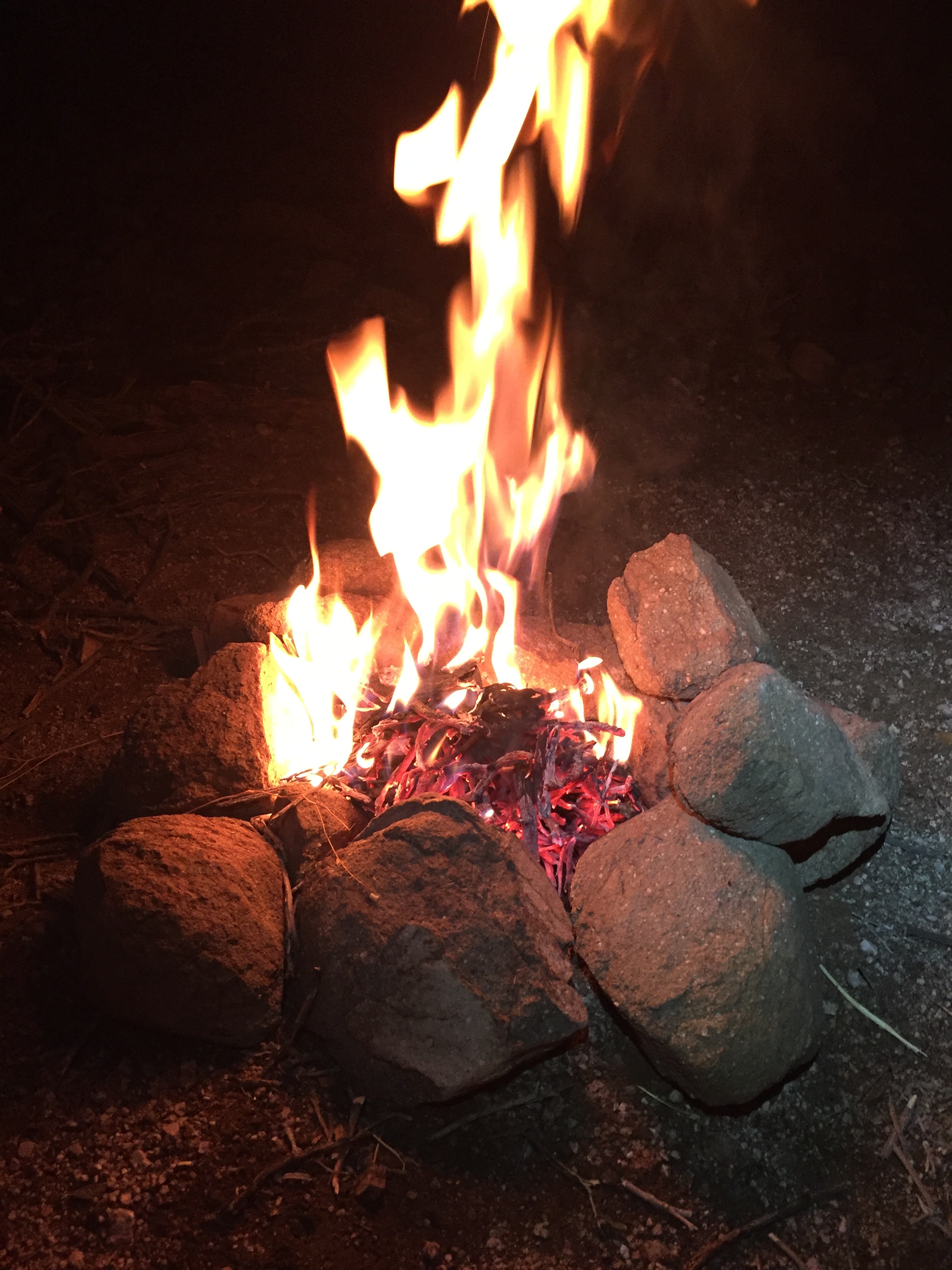
Fire is always good for the soul
The weather was nice and calm this day and there wasn't a cloud in the sky. Camp once again setup very quickly and I put on water for dinner. While my insta-meal was simmering in its bag I gathered up some firewood consisting of mostly dead cholla and sagebrush. I built a little ring of rocks and sparked up a nice fire that warmed up the cool night. Eating dinner next to the orange flames and looking up was such a peaceful and spiritual feeling. Middle of nowhere, sky so full of stars it seems like you could touch them. I tucked in and easily drifted off to a hard sleep.
There were a couple of things I wrote down this evening that I need to make sure I bring for the race in April.
- Slime tubes or tubes that have removable cores that can be filled with sealant.
- Some sort of quick link tool. Maybe print this one: http://www.thingiverse.com/thing:1405895
- Need to label my kLite bar switch (lights vs. USB)
- Water treatment. I kept going back and forth in my head on this. Filter or aquamira. So many of the sources that need to be filtered are so nasty that they are going to clog a filter quickly. Chemical treatment is probably the best bet.
Day 2 numbers:
- Oatmeal & coffee for breakfast. Sausage, cheese and crackers for lunch. Didn't eat a ton on the bike.....trail mix, bobo bar, stroopwafel and a probar.
- 1K calories at dinner
- 8 hours & 16 minutes of riding (6hr 32m moving time)
- 38.5 miles - 4.65 mph average (5.9mph moving)
- 3815' vertical gain
- Strava activity here: https://www.strava.com/activities/806546314
Day 3
I woke up to a pretty awesome sunrise over the Gila but was freezing. There was a layer of frost over all of the bags on my bike and my 45F bag was not going to cut it in these conditions but I managed to stay pretty toasty wearing all of my camp clothes, thick wools socks and a down jacket. Today I would need to ride about 14 miles to knock out the Gila River passage then another 11 to descend into Picketpost. The elevation profile for the rest of this passage was a little intimidating but the morning started out pretty awesome continuing along the river. I decided to just start out with my normal cool weather clothes knowing that the temps would come up quick with the sun. This consisted of a craft base layer, bibs and Twin Six jersey adding on thin knee warmers and arm warmers. Handup Gloves for grip and protection from the pointy, pricky things of the desert worked great.
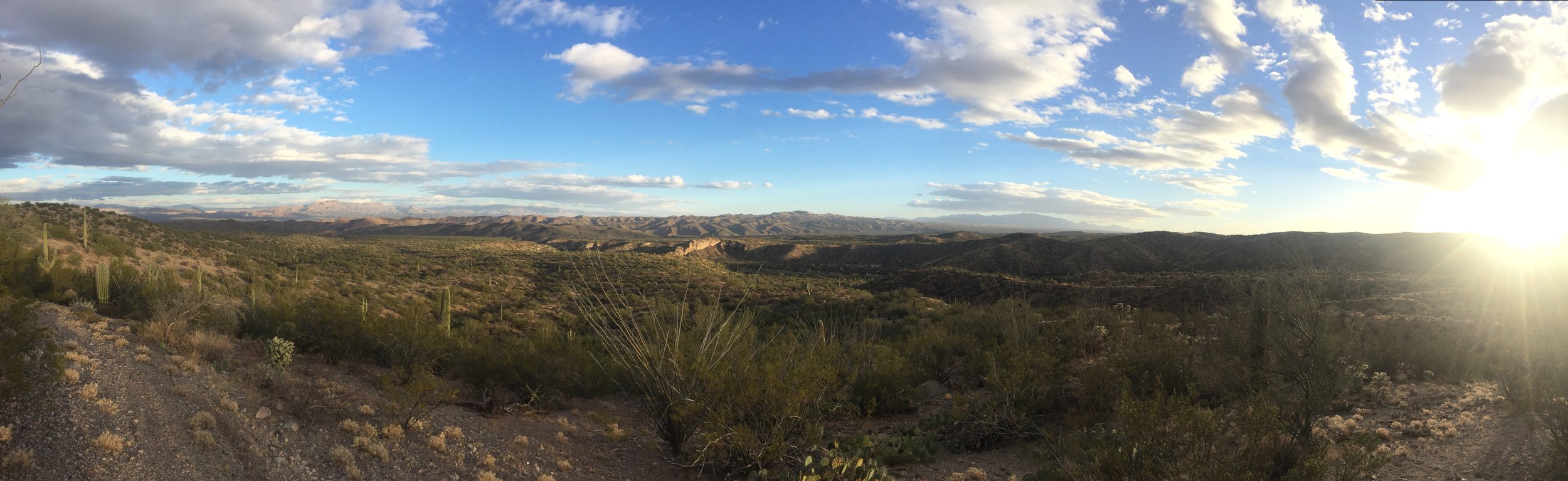
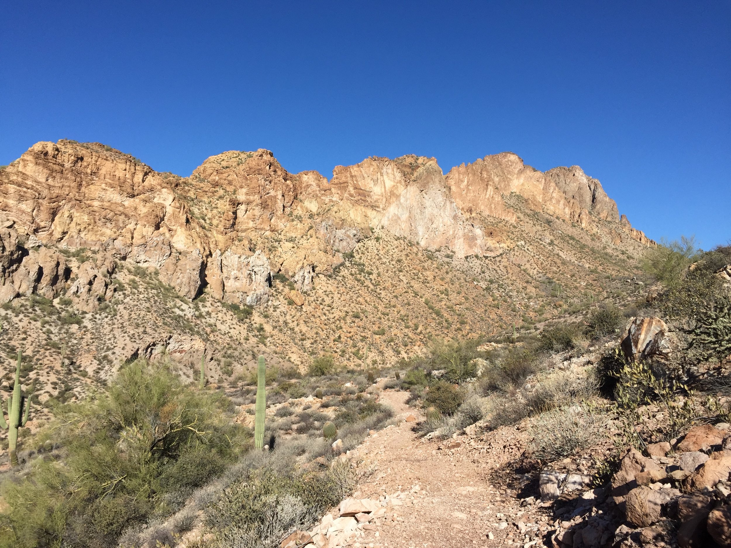
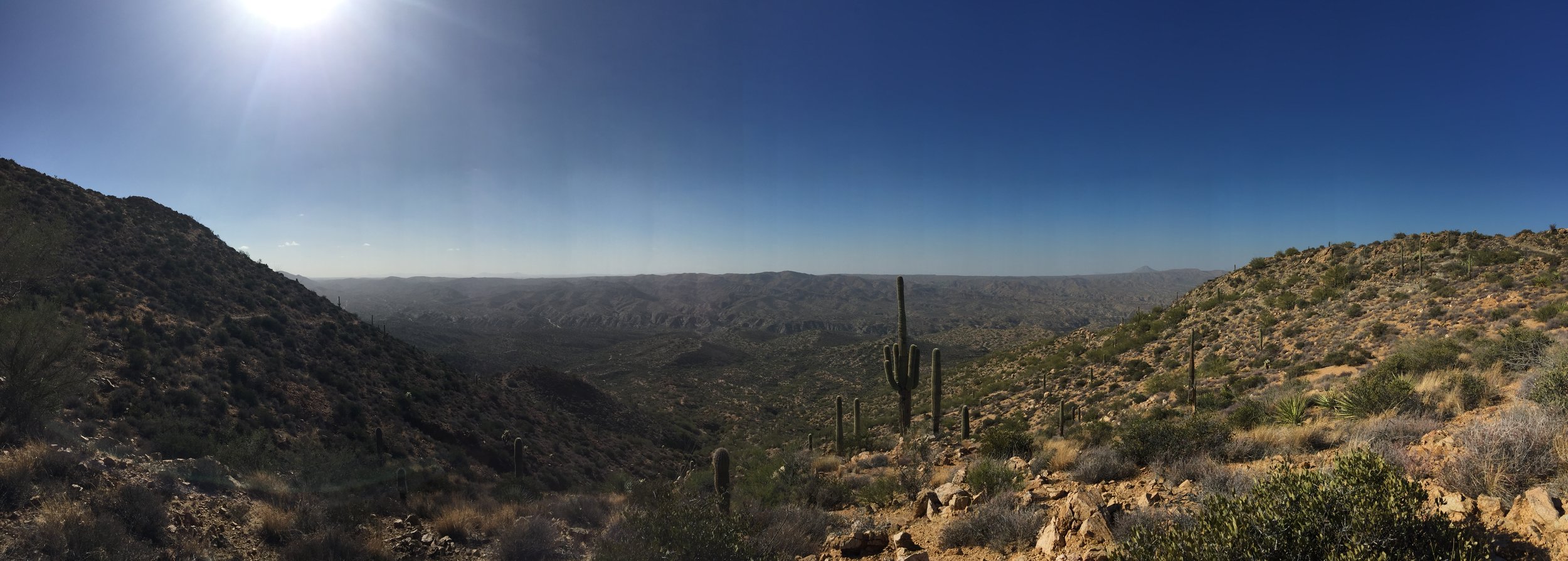
Seven miles in and the trail ran into Red Mountain Road and the route headed due north away from the comfort of the Gila River. Things got steep and very rocky very quickly. Big chunky fire road and double track lead to switchback after switchback heading up canyons giving way to some of the best views I had seen. Expansive vistas of ridge lines stacked up as far as you could see. Huge stands of saguro forests piled into the ravines. It was interesting to see dead or burnt saguros that revealed their woody internal skeleton. It was easy to see how they are just a kind of easily expanding bladder to hold onto the scarce water of the desert. The greenness of the desert actually really surprised me. Previously when I thought of the desert I just thought of wasteland but this is far from it. There is so much life here.....just not what we are accustom to in the eastern United States.

Making my way up into the mountains towards Tonto National Forest
Finally topping out the big climbs around midday at the gate that divided passage 16 & 17 was welcome relief. There was a supply box that was flush with bottled water shaded by a tree. It was a nice place to take in some lunch and relax a bit. I also replaced that rear tube that had started leaking faster and faster. It was comforting to find the remains of the thorn that had caused a puncture pulling it out with leatherman pliers which I would call a required tool on this route.

Great caches on the sections I rode.
Passage 17 descending eleven miles into the Picketpost trailhead was a whole lot of awesome. Mostly downward trending with a few technical sections gave me another good dose of switchbacks. Down into washes then back up onto trail. Reflecting on the torn tire I think I figured out how it happened. I have a bad habit of excessively dragging my rear wheel when braking down steep descents. I am pretty confident that I did this over a sharp rock. I need to work on being a little more smooth while scrubbing speed. I rolled into Picketpost around 4pm and found a spot near the parking lot to setup camp. There was water next to the trailhead that I used for cooking dinner and refilling a bit for the next day. After bedding down after sunset there was a flurry of people and vehicle activity outside culminating in a sheriff helicopter dusting down into the parking lot around 8pm. Evidently someone had gotten either stranded or injured on Picketpost mountain and they had sent out a pretty aggressive search party. The chopper landed and took off a few times then everything quieted down by around 10 o'clock.
This last big day of trail started pretty hard but ended with a lot of fast fun action.
Day 3 numbers:
- Oatmeal and coffee for breakfast. Snacks throughout the day. Sausage, cheese and crackers for lunch. Dinner was another nice hot meal.
- 7 hours and 56 minutes (6hr 2m moving)
- 28.7 miles - 3.62 mph average (4.8mph moving) - LOTS of hiking
- 4554' vertical gain
- Strava activity here: https://www.strava.com/activities/806546662
Day 4

Iconic Picketpost Mountain
I had thought about doing the Gold Canyon loop today but given the compromised tire and wanting to make good time back into town, I took a pretty direct route. Heading out of Picketpost there were a couple of miles of singletrack that gave way to Hewitt Station Road which was a very fast and fun gravel segment taking me into the tiny community of Queen Valley. Leaving this town on a nice two lane with bike lanes sent me on the only questionable section the entire route. I went back and forth a few times between two gates in a fence that were both marked no trespassing, something something permit required. I saw a few bicycle tire tracks and there was no one around so I trespassed as fast as I could hopping onto a fast, rugged powerline access road. Five miles of this road ended up dumping onto US60. I was warned that this was a fast and dangerous road but I found it to be a very safe feeling 4 lane with a large, clean shoulder that rode really well. The sad part here was that it was starting to feel like civilization. RV Sales, strip malls and restaurants. Good thing is that this could be a solid resupply for the race.
My route back into Gilbert was a pretty uneventful 15 miles through suburban RV retirement communities that gave me a chance to space out and reflect on the past couple of days. It was much harder than I imagined but I am so happy I was able to come out to this incredible corner of the world to get a little taste before I took a huge bite of it in April. The 100 miles at a very easy pace was nothing compared to the massive scale of moving across the entire state of Arizona as fast as possible in just a few months.
Day 4 numbers:
- 3 hours 56 minutes (3hr 21m moving)
- 46.9 miles - 14mph moving average (LOTS of asphalt and gravel)
- 1K vertical gain
Stay tuned for more stories as I prepare for this massive race across the state. I hope this can be a good reference for anyone that is looking to take on part or all of this incredible trail that has a very interesting (and relatively short) history. I have joined and I would recommend that you join the Arizona Trail Association (http://www.aztrail.org/) and pick up the AZT Guidebook.
The route I rode can be found here: https://ridewithgps.com/routes/17924981
Information about the Arizona Trail Race can be found here: http://topofusion.com/azt/race.php